Still a Frontier Town

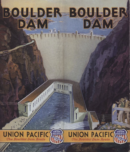
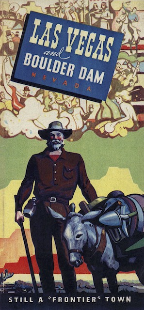
With close to 650,000 residents (as of 2021), Las Vegas is the nation’s 25th-largest city. But in 1939, when Union Pacific issued this brochure, it had barely 8,000 residents, making it “still a frontier town,” according to this brochure. The completion of Boulder/Hoover dam just three years before (along with the invention of air conditioning) enabled the city to rapidly grow into one of the nation’s leading entertainment centers.

Click image to download a 19.6-MB PDF of this brochure, which is from the David Rumsey Map Collection.

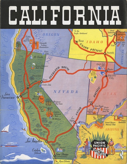
The colorful map in this brochure includes cute pictures of yellow Union Pacific streamliners, a couple getting a divorce at the Clark County Courthouse, and even a scantily clad woman enticing a man to enter her doorway over which is mounted a red light. The map barely hints at casinos or gambling but instead focuses more on natural resources such as Red Rock Canyon, Death Valley, Zion, and of course Boulder Dam. Similarly, the photo collage on the back has one picture of a roulette table and 18 of scenery, a rodeo, and the dam.

The map and cover art are signed Raymond Winters, who was born in Denver in 1892 and moved to Los Angeles in 1915. As an artist, he often illustrated the covers of Westway magazine, which then as now was published by the Automobile Club of Southern California. Sadly, he died in 1939, the same year this brochure was published.

About the Streamliner City of Denver

“Beginning June 18, the twin trains of the City of Denver will provide the only 16-hour, streamline train service between Chicago and Denver,” says this brochure. That dates it to 1936, the year the train began operation.

Click image to download a 14.3-MB PDF of this 52-page booklet.

We’ve previously seen a 3-1/4″x5-1/2″ 28-page glossy booklet about the 1936 train. This brochure isn’t printed on such fine paper, but it has most of the same photographs as the booklet and much of the same text. The brochure unfolds out to 11″x16″, which means it has about 352 square inches of space compared to the 500 square inches in the booklet. Since four of the booklet pages are blank, it really isn’t much bigger than this brochure. However, thanks to the better paper, the photos in the glossy version are much clearer.

Moderne Old Faithful Menu

We’ve seen this cover before on a café car dinner menu. This one is a breakfast menu. As with all menus in the Moderne series, the images and back cover text are identical to those on an earlier Art Nouveau series menu.

Click image to download a 1.2-MB PDF of this menu.

The color picture of Old Faithful is based on a black-and-white photo taken by Frank Haynes in around 1910. It is a little surprising that UP didn’t update this with a natural color photo, as it had done for scenes of Zion and Bryce Canyon national parks on the Art Nouveau and Moderne menu series. The print date on my Art Nouveau menu is June 1934, so UP would have had plenty of time to take newer photos. Continue reading

Longs Peak Moderne Menu

Here’s a Union Pacific menu we haven’t seen before. We have seen the color photo on a 1929 menu in the Art Nouveau series. Most of the cover photos from that series were also used in this series, which I call Moderne, but could just as accurately be called Art Deco.

Click image to download a 1.5-MB PDF of this menu.

The Art Nouveau series featured 17 different cover photos, but three of them were nearly identical shots of a scene in Bryce Canyon while three others were nearly identical shots of the Great White Throne in Zion. I am pretty sure only one of those photos of each scene made it to the Moderne series. One of the other photos shows a deck and stonework that was part of the Grand Canyon Lodge that was built in 1927. The lodge burned in 1932 and was not rebuilt until 1936, so I don’t think UP would have made a menu with that photo in the Moderne series, whose covers were printed only in 1935. Continue reading

Boulder Dam in 1935

At 726 feet, Boulder Dam was the tallest in the world when it was completed. Although it wasn’t formally done until 1936, it was dedicated by President Roosevelt in September, 1935. Union Pacific published this brochure just one month later. The dam was a source of pride for Americans, and for Union Pacific it was a source of revenue as most of the construction materials were brought in by rail.

Click image to download a 19.6-MB PDF of this brochure.

The name “Boulder Dam” is a misnomer as a dam was originally proposed for Boulder Canyon but ended up being built in Black Canyon. The 1928 law authorizing a dam “at Black Canyon or Boulder Canyon” was called the Boulder Canyon Project Act, but didn’t name the dam. When construction began in 1930, the Secretary of the Interior declared it should be named after President Hoover, who was an engineer himself. But when Roosevelt became president, the Democrats didn’t want to finish a dam named after a defeated opponent, so insisted it be called Boulder Dam. In 1947, however, Congress declared that it should be named Hoover Dam. Continue reading

California Easily in 2 Weeks

“It’s surprising how much of California’s unusual attractions vacation travelers can see” in two weeks, urges this brochure to travel agents. This would allow two days each in Los Angeles, San Diego (with a side trip to Mexico), Yosemite, and San Francisco with time for some side trips to other California places such as Catalina Island, Santa Barbara, and Del Monte. Other side trips could include Yellowstone, Colorado, Bryce, Zion, the Grand Canyon, and “gigantic Boulder Dam,” but only “if you route your patrons via Union Pacific.”

Click image to download an 2.5-MB PDF of this brochure.

While the map on the cover of this brochure doesn’t include Portland, the text notes that tourists who wanted to visit the Rose City could “add the thrill of a return trip on Union Pacific’s new, high-speed train, The Streamliner–City of Portland.” The streamliner had entered service on June 6, 1935, less than a month before this brochure was published. The term “high-speed train” made sense as it was 20 hours faster than any other train between Chicago and the West Coast. Passengers to Los Angeles would have to wait until May 1936 and those to San Francisco until June before they could take a train that was that fast. Continue reading

Concerning the New Advantages of Train 14

This has to be one of the lamest railroad brochures I have ever seen. The passive opening headline, “Concerning the new advantages. . .,” absolutely would not inspire me to open it. Why is it about “train 14” and not the Pacific Limited, which is a much more attractive designation?

Click image to download a 1.9-MB PDF of this brochure.

Worse, before this brochure, the eastbound Pacific Limited was numbered 20, not 14. The number was changed to 14 on April 1, 1935. So by advertising “train 14” on the cover, UP was promoting a train number that northwesterners didn’t even identify with the Pacific Limited. Continue reading

Southern California in 1923

We’ve previously seen UP booklets on California from 1915 and 1921, which had similar (though not identical) covers but different text and photos inside. However, they both covered the entire state, including the redwoods, the Bay Area, the Sierras, and southern California. This booklet is focused only on the latter region, meaning “Los Angeles, San Diego, Santa Barbara, Pasadena, Long Beach, Riverside, Santa Ana, [and] Redlands.”

Click image to download a 11.1-MB PDF of this 36-page booklet.

The booklet has a lot of photos, but they look like someone just discovered photoshop. Almost every photo is really two photos, one inlaid over the other. For example, pages 12 and 19 show pictures of California highways, and as if to reinforce that they are highways, someone has pasted photos of cars which were apparently driven by drunkards as they are not going straight down the roads. Continue reading

Birdseye View of Great Salt Lake Basin

Despite the name on the cover, the map on the back of this brochure only shows the Salt Lake Basin north of Ogden. Moreover, it extends well beyond the basin into the Snake River and Missouri River headwaters. Basically, it is a map showing Union Pacific’s branch line to Butte, but it also shows a rail line extending to Helena, which Union Pacific didn’t reach.

Click image to download a 31.5-MB PDF of this brochure.

Union Pacific once went as far as Garrison, Montana, about 50 miles north of Butte. The Butte-Garrison portion was called the Montana Union Railway and it was jointly owned by Northern Pacific and Union Pacific. In 1898, five years after this brochure was published, UP decided it didn’t need to reach Garrison, so it leased its half of the line to Northern Pacific for 999 years. Continue reading

The Pacific Slope in 1893

This birdseye map show the “Pacific Slope,” which mostly means California with bits of Nevada off in the distance. Having been made in the early 1890s, almost all of the rail lines shown on the map are Southern Pacific, and the few exceptions are Santa Fe. Not one mile of Union Pacific track is shown, but railroads often advertised destinations they didn’t actually serve if getting to those destinations meant using their lines for part of the route.

Click image to download a 25.7-MB PDF of this brochure.

The Southern Pacific’s Coast Line was not yet complete, with a large gap between Santa Margarita and Santa Barbara that wouldn’t be closed until 1900. There’s no hint of the Los Angeles and Salt Lake Railroad, whose construction began in 1901. Passengers going to southern California had to take the Union Pacific to Ogden (not shown), the Central Pacific (by 1890 leased to the Southern Pacific) to Sacramento, and then the Southern Pacific down the Central Valley to Los Angeles and from there the California Southern (part of the Santa Fe) if they wanted to go to San Diego. Continue reading