We’ve seen an edition of this brochure from the late 1930s and one from about 1950. Here’s a version from around 1916 that features not only the Rio Grande but Western Pacific’s Feather River route. The brochure’s map is dated “4-20-’16,” which doesn’t definitively prove the brochure was issued that year. However, it wasn’t much later than that, as the Denver & Rio Grande (which financed construction of the Western Pacific) lost control of WP in 1918, and after 1920 it called itself the Denver & Rio Grande Western.
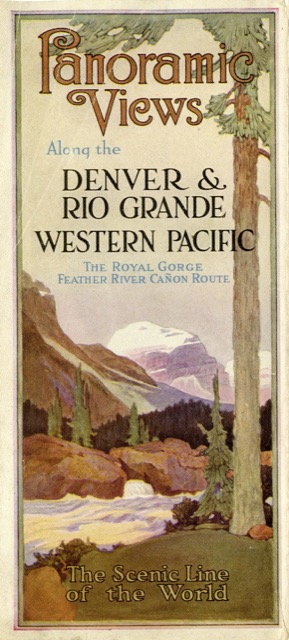 Click image to download a 12.0-MB PDF of this brochure.
Fittingly, this brochure is a little longer than the later ones that only cover the Rio Grande: 14 panels wide instead of 12. The nine hand-colored pictures on the back (five of which are two panels wide) are gorgeous. While Western Pacific has a presence, the bias is clearly to the Rio Grande: five panels of text and five photos for the Rio Grande compared with two panels and three photos for WP (plus one panel and one photo at the meeting point, Salt Lake City).