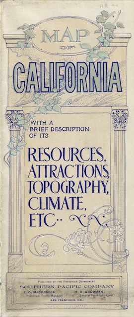
The cover of this brochure says “resources, attractions, topography, climate, etc.,” but the map on the other side doesn’t show any of those things. Instead, it mainly shows state and county boundaries, Southern Pacific rail routes in thick lines, other rail routes in thin lines, and roads in faint dotted lines. If the map is to be believed, in 1901 the only roads in California fed into, but did not parallel, the rail lines.
 Click image to download a 15.6-MB PDF of this brochure.
The map also shows the location of cities, but only as stations on the rail lines. Los Angeles is shown as a small circle but I suspect even in 1901 its boundaries were bigger than that. San Francisco is shown at its current extent, but that’s the county boundary, not the city boundary of 1901.
Southern Pacific also apparently had not yet learned about the invention of the staple. This brochure fills as much space as 18 pages of a standard 8″x9″ railroad timetable or booklet, but SP chose to print it as a giant, unfolding brochure. While a map this large wouldn’t fit on an 8″x9″ page, unfolding 22-1/2″x27″ brochure was unwieldy, while dividing the state up into, say, north, central, and south sections would have been an acceptable way to fit it into a booklet at the same scale as in this brochure.
The text side of the brochure does discuss resources, attractions, topography, climate, etc., but the print was small enough to strain the eyes of many of its intended audience. In those days that preceded the widespread use of half-tone photographs, lots of text often substituted for illustrations. The map itself is very pretty, being printed in three different colors.
Most of the rail lines on the map still exist. An exception is a line from Carson City south to Keeler, California. Though printed as a thick line (meaning Southern Pacific), this line is marked “Carson and Colorado Railroad.” This was a narrow-gauge line that had been owned by the Virginia and Truckee, which sold it to Southern Pacific in 1900. As the map shows, the C&C’s only connection to SP’s other lines was via the Virginia and Truckee, but the need to transship goods from narrow gauge to standard gauge cars limited its usefulness. Despite this, some of it lasted until 1960.
The other lesson to be learned from this brochure is that in 1901 Southern Pacific was still heavily focused on attracting settlers, a focus that would not give way completely to tourism for at least a decade. California was highly successful in attracting settlers, as its population grew by 60 percent in just the ten years between 1900 and 1910. However, much of that growth was due not to Southern Pacific alone but to the competition between Southern Pacific, Union Pacific, and Santa Fe, which drove down fares and made travel to California more affordable to residents of the rest of the United States.
This map and the text on the other side are from the David Rumsey Map Collection and are reprinted here with permission. I turned them into a PDF, which makes them easier to download by reducing their size.