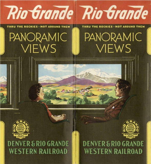
This is an update to an undated version of Panoramic Views shown here previously. The map on that one shows the Dotsero Cutoff and Uintah Railway, placing it in the 1934-1939 time period. The Uintah Railway, which stopped operating in 1939, doesn’t appear on the map on this edition, which is firmly dated by a 1941 mark in the lower righthand corner.
 Click image to download an 8.2-MB PDF of this brochure.
The two editions share seven photos, but this one has six photos not found in the earlier version, including Arches National Park (then a monument), Glenwood Springs, and Pikes Peak. The covers are also completely different; personally, I find the illustrations of the Moffat Tunnel and Royal Gorge on the older brochure, as small as they are, to be a lot more attractive than the sedentary passengers watching a somewhat imaginary scene pictured on the cover of this one.
My favorite part of this brochure is the interesting map treatment. It’s clean and linear in design. It gives the impression that Chicago to the Pacific Ocean transit is smooth and simple (though it actually would require changing railroads multiple times).