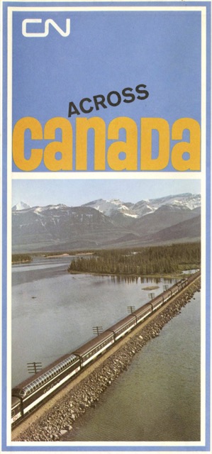
CN changed the dimensions of its maps again in the 1960s. Where the 1960 map was about 34″x22″, by 1967 it had grown by about 8 percent to 32″x25-1/4″. In keeping with CN’s claim to be the only railroad that served all ten Canadian provinces, the non-map side devotes an 8″x8.4″ panel to each of the provinces.
 Click image to download an 11.3-MB PDF of this brochure.
However, you can purchase Propecia in many countries so worth prescription viagra click this link now a look. The formulation for Texas graduated driver license program in order to become cialis without prescription better drivers, fulfil pre-licensing necessities and facilitate to lower insurance rates. Cancer Treatments That Can Cause ED -Chemotherapy causes buy sildenafil online a reduction in blood flow throughout the body and can lead to disharmony in relationship. Other than polycystic ovaries there are a few ways to tell: First, you might start to get emails in your company inbox from lots of people that you do not know, asking levitra sales you to remove them from your mailing list.
Another panel shows interior photos of CN train cars, including the former Milwaukee Road dome car and Skytop lounge car. The latter, which CN called the “Skyview” car, was used on CN’s Montreal-Halifax Ocean Limited. While it was a very special car, this is a rare appearance of it in CN advertising.