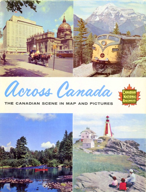
Canadian National’s 1960 map is lavishly illustrated with 34 full-color photos on the side opposite the map. At 34″x22″, this is a little larger than previous CN maps, which were about 32″x18-1/2″.
 Click image to download an 11.4-MB PDF of this brochure.
The locomotive on the cover is looking a little faded, suggesting that CN’s green-and-yellow paint scheme was not only boring but not very weather-resistant. Or possibly CN was already contemplating a new paint scheme in 1960 (which, when introduced in 1961, would be even more boring) and wasn’t bothering to keep up appearances on the old one.
Every once in awhile the InDesign software I use to make PDFs goes crazy and makes PDFs that are overly large. I scan at 300 dpi, but at that resolution this PDF is 83.5 megabytes, or about eight times what it should be. With trial-and-error, I found that reducing the resolution to 290 dpi didn’t help much, but reducing it to 280 made it a much more reasonable size. That’s what you get if you click on the image above, but if are willing to accept an 83.5-MB file, you can have the full 300 dpi.
