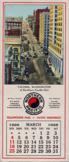
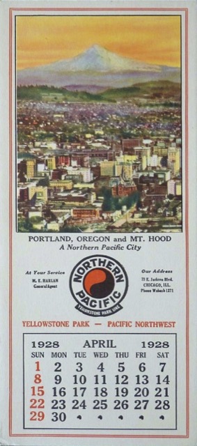
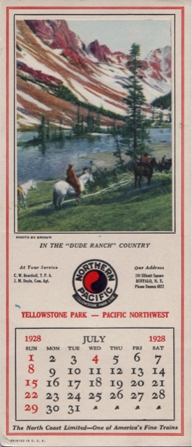
Some of these blotters, all but one of which are from the Dale Hastin collection, continue to show “Northern Pacific cities” along with some Montana scenery.
Click image to download a PDF of any blotter PDFs average about half a megabyte.
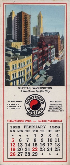
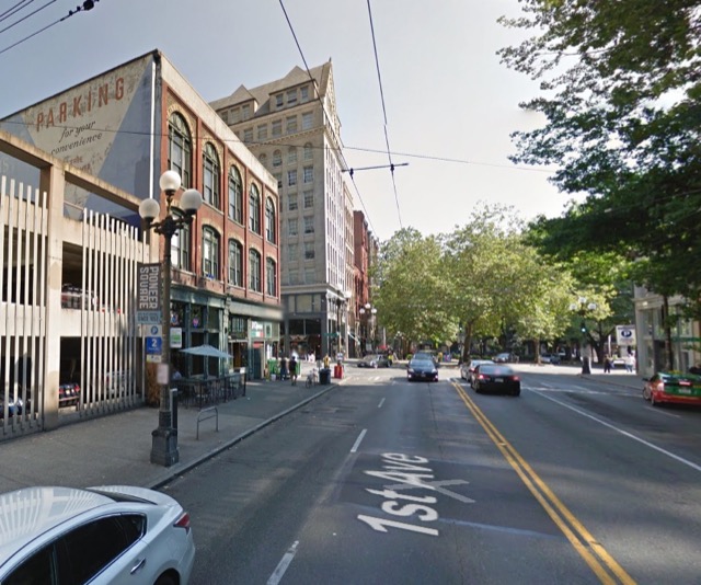
When this photo was taken, Smith Tower, in the background, was the tallest building in Seattle. The photo is looking down 1st Avenue towards what is now Pioneer Square. Most of the buildings on the left have been replaced while the ones on the far right still exist as shown in the Google street view below.
The March blotter shows Tacoma, which truly was a Northern Pacific city. Although a community called Tacoma existed before the NP reached Puget Sound, NP located its station and the city’s future downtown two miles away from that community. In an effort to promote its Northwest terminus, for decades, NP tried to persuade people that the real name of Mt. Rainier was Mt. Tacoma.
Northern Pacific was the first transcontinental to reach Portland, but it did so over the rails of the Oregon Railway & Navigation Company, which was locally built but, for a time, controlled by Henry Villard, who oversaw NP’s construction to the Northwest. I found (but did not buy) this Portland blotter on eBay.
The July blotter shows NP didn’t focus exclusively on NP cities in 1928. Unfortunately, I don’t recognize the scene and don’t know who Brown was.
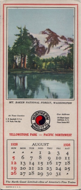
Although Mt. Baker was originally in the Snoqualmie National Forest, which was created in 1908, it was split off into its own national forest in 1924. (Later, the Forest Service managed the two of them together as the Mt. Baker-Snoqualmie National Forest.) The mountain in the picture isn’t Baker but is Mt. Shaksan, while the lake is probably Picture Lake.
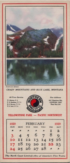
Getting to Blue Lake in Montana’s Crazy Mountains today requires an eight-mile hike, and it was probably more in 1928. So, unlike Multnomah Falls and other sites on most of these calendar blotters, few NP passengers ever saw the scene shown in this photo.
