There are “four ways to see Glacier Park,” says this 1939 brochure: hiking, motoring, horseback riding, or boat. Each of these are illustrated by one or more of the eight black-and-white photographs on the front of the brochure.
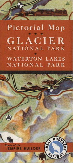 Click image to download an 18.9-MB PDF of this brochure, which is from the David Rumsey Map Collection.
The map on the back is more realistic than yesterday’s. Though it still shows oversized images of trains, autos, boats, hotels, and people, none of them are presented in humorous situations. The map, unfortunately, isn’t signed, but whatever artist did the map didn’t need to do a separate cover illustration as the cover is merely a detail of the map showing Many Glacier Hotel and Going-to-the-Sun Chalets.
One peculiar feature of the map is the international boundary, which is supposed to follow the 49th parallel (though due to surveying errors it may vary a few hundred feet). On this map, however, the boundary is shown following geographic features such as the ridge of the Boundary Mountains. Neither the Park Service nor the USGS maps of the area show the boundary in this way. Did Great Northern try to shift the boundary, perhaps to make it easier for hikers and horseback riders to negotiate certain trails without having to go through customs?