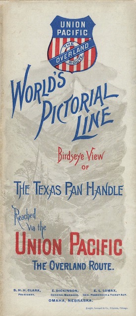
“By the recent acquisition of the Denver, Texas & Fort Worth Railway, the Union Pacific System controls an imperial domain extending from the mountain heights of Colorado to the Gulf [of] Mexico,” proclaims this brochure, which includes a colorful “birdseye” map of territory extending from Cheyenne to Fort Worth. Completed in 1888, the Denver, Texas & Fort Worth, which Wikipedia calls the Fort Worth and Denver Railway, was built by Grenville Dodge, who also led construction of much of the Union Pacific.
 Click image to download a 22.0-MB PDF of this brochure.
Union Pacific gained control of it in January, 1890 but lost control when UP went bankrupt in the panic of 1893. The Fort Worth & Denver was reformed as the Colorado & Southern, which the Burlington Route bought in 1908. By that time, the Burlington was controlled by James J. Hill while Union Pacific was controlled by Edward Harriman, so the loss of the Fort Worth route to Hill must have been annoying to Harriman.
This brochure is undated but it refers to the 1880 census and population estimates for 1888 and 1890, so it must be from 1890 or soon thereafter. It contains no photographs or artwork other than what is on the cover and the map itself. Instead, it has 28 panels each with about 550 words of tiny text for a total of around a 15,000-word travelogue describing a trip from Cheyenne to Fort Worth.
This brochure is from the David Rumsey Map Collection. Rumsey is a San Francisco real estate developer who began collecting historic maps in the early 1980s (which, coincidentally, is when I began collecting railroad memorabilia). He had a few more resources behind than I do, so by the early 2000s his collection included more than 150,000 maps.
By 2008, he digitized 16,000 of the maps and posted them on line. In 2009, he donated the collection to Stanford University, which has since digitized and posted a total of 115,000 maps. Some of these maps were published by railroads as a part of advertising brochures, in which cases Stanford has digitized the entire brochures.
The high-resolution files Stanford has posted are very large: the two jp2 files for this document are more than 110 megabytes. I’ve combined them into a single PDF, run them through optical character recognition software (which only works for text that is upside-up), and compressed them slightly so that the final files are much smaller, though still pretty large. I appreciate Rumsey’s generosity in making these files available with a creative commons license that allows me to turn the jp2 files into PDFs and post them with credit to Rumsey.