Unlike many of CN’s pre-war booklets, the pretty image shown below is on the front cover, rather than the back cover, of this guide. The first half covers what to do in Jasper and the second half describes the Triangle Route. A statement in some CN advertisements that the Triangle Route was 2,000 miles long has been toned down to 1,850 miles.
 Click image to download a 7.4-MB PDF of this 16-page booklet.
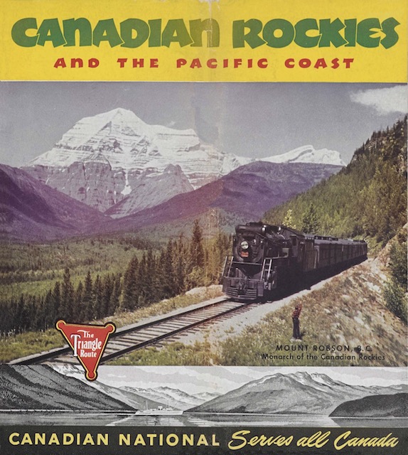
When I see a photo like this, I wonder how the boy waving at the locomotive managed to scramble his way onto the fill. As near as I can tell from maps, the train is westbound (and therefore going downhill). The photographer is looking northeast towards Mt. Robson. At this location, the railroad is on a hillside east of the Robson River valley, while the Yellowhead Highway is in the valley bottom west of the river. Today, at least, there is a hiking trail from the highway towards Mt. Terry Fox that crosses the rail line not too far from this photo location, so perhaps the photographer and the boy took that trail.
Scans of this booklet came from archive.org, which at least got the page order correct in its PDF. But I cleaned up some pencil marks and made a few other improvements for the PDF shown here.