
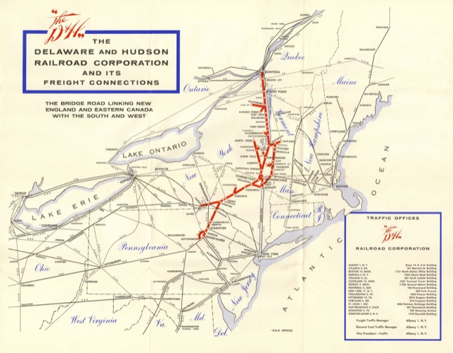
The Delaware & Hudson considered itself the nation’s oldest “continuously operated transportation company,” as it started in 1823 to build and operate a canal that opened in 1828. The canal was converted to a railroad in the 1860s. The railroad failed to turn this early start into an empire, so by 1940 it advertised itself as a “bridge” between Canadian and American railroads.
 Click image to download a 1.8-MB PDF of this map.
This map is undated, but it uses postal codes (which began in 1943), not zip codes (which began in 1963), so it must be from sometime between those two years, and probably from the 1950s. The elegant script used for “The D&H” is also used for state and provincial names, but the envelope containing the map (below) is more prosaic. Although the map specifies it shows “freight connections,” up until Amtrak the D&H operated two passenger trains between Albany and Montreal, the overnight Montreal Limited and the daylight Laurentian.
 Click image to download a 301-KB PDF of this envelope.
It must have been from before 1960. It still shows the Lackawanna and Erie as separate lines, and they merged in 1960.
Regards, Jim