The vacation guide side of this brochure has 7″x9″ panels devoted to each of Burlington’s most scenic destinations: Glacier, Rocky Mountain, and Yellowstone parks, the Pacific Northwest, and California. Half panels briefly describe the Black Hills, dude ranches, and the Mississippi River scenic line.
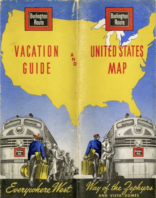 Click image to download a 14.1-MB PDF of this map.
The map doesn’t quite show the entire 48 contiguous states, as the Texas and Florida panhandles are off the page. It is always interesting to see what railroads are emphasized on these maps. The Burlington’s own lines, of course, are thickest, but GN, NP, and SP&S aren’t much thinner. Rio Grande, Santa Fe, and Western Pacific are next thickest, but surprisingly Southern Pacific and the Golden State portion of Rock Island’s line are just as thick as is UP’s Salt Lake-LA route. Eastern and Canadian railroads are next, and Union Pacific’s line from Cheyenne to Oregon are in the same category. The thinnest lines are reserved for Union Pacific and other railroads that compete directly with the Burlington plus various branch lines that offer little or no passenger service.