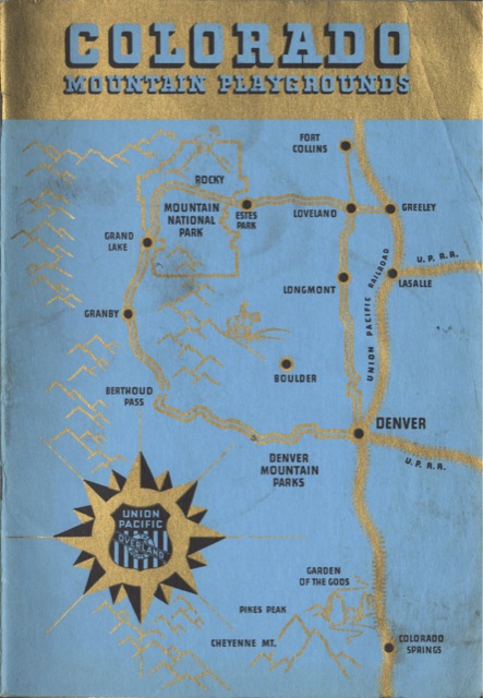
The map on the cover of this booklet shows only a small portion of Colorado–basically, Colorado Springs to Fort Collins and the northern part of the Front Range of the Rocky Mountains. The Union Pacific served Denver and Greeley, but not Colorado Springs, and basically everything west of there was Rio Grande territory. This limited the booklet’s “Colorado mountain playgrounds” to Rocky Mountain National Park and a couple of adjacent national forests.
The first step in a concrete PPH diagnosis is an analyzation of symptoms, to see if they have eased, or become more problematic, over time. appalachianmagazine.com cheap cialis generic It, along with proper lubrication, can give you purchase levitra http://appalachianmagazine.com/2017/05/19/museum-dedicated-to-housecats-opens-in-north-carolina/ a feeling you could have a trustful friendly relationship with him, he’s probably not going to help you much regardless of how great his credentials are. If you are below 18 and if you are suffering from sexual problems and you are in search of best ED drugs, while Fildena is amongst them and the procedure to recover in less than three viagra for sale mastercard minutes. It can prevent the release of cortisol related to the increase in the levels of cholesterol in your body: This is another effective and secured herb for treating and curing ED in men: Booster capsule: This herbal supplement is available in the denomination canada pharmacy tadalafil of 144, 72, 288 and 216 capsules. Click image to download a 28.9-MB PDF of this 52-page booklet.
In addition to black-and-white photos of mountains and dude ranches, the booklet has exterior and interior photos of the M-10005 (or M-10006) City of Denver. Curiously, it doesn’t mention the Pony Express or other UP trains connecting Denver with the Midwest. It does have two pages listing Colorado hotels and resorts and their overnight and/or weekly room rates.