We’ve previously seen a 1932 booklet with the same covers as this one. However, the interiors are quite different. While some of the text is in both booklets, it has been extensively rewritten. While some photos are in both booklets, the ones in both have often been resized.
 Click image to download a 14.1-MB PDF of this 16-page booklet, which is from the David Rumsey map collection.
The designer of today’s booklet placed all of the photos in one of four frames on each page: a circle, a rectangle with curved corners and a truncation out of one corner from the circular frame, and two other shapes that also have truncations to allow the circular frame. On some pages this set of four frames is flipped horizontally and some it is flipped vertically, but all of the photos fit into one of these frames. The designer of the 1932 booklet, by contrast, just put most of the photos in rectangular frames. While this is less creative, it does allow for some photos to be much larger than any of the four frames in today’s booklet.
Neither booklet is dated, but the previous one announced that the American Legion was holding its national convention in Portland in September 1932, so I dated it to that year. Today’s booklet says the population of Portland was 352,000 in 1929, so I would date it to 1930.
“Famous trains use [the] Columbia River scenic route,” announces both booklets, namely “the well famed limited transcontinental train service of the Great Northern and Northern Pacific Railways.” Neither booklet specifically names those trains, but we know they were the Empire Builder and North Coast Limited plus the secondary Oriental Limited and Alaskan. Apparently, Great Northern wasn’t concerned about naming conventions as the Empire Builder wasn’t called the Empire Builder Limited, and while the Oriental Limited was a limited train when it was first introduced in 1905, it was displaced from that status when the Empire Builder was inaugurated in 1929.
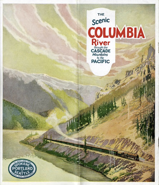
The cover painting shown above (which is the back cover) isn’t signed, but the front cover is a map of the Northwest signed “Routledge.” That’s Fred Routledge (1871-1936), who made maps for the Portland Oregonian newspaper and other Northwest businesses including several railroads. Routledge and his wife, Lydia McGowan (1870-1959), who was also an artist, lived most of their lives in Northeast Portland, not far from where I grew up. “Not infrequently he was responsible for the cover art on brochures that featured his pictorial maps,” says an Oregon Historical Society article about Routledge, so he probably did the back cover illustration on this booklet as well.