Canadian National issued several annual booklets about travel in the western provinces that complemented and blended into one another. The Jasper Park booklets described the lodge and the park and included a detailed list of activities and costs in the back. The Jasper Lodge booklets described the park and the lodge but did not include such activity schedules. The Canadian Rockies booklets, including this one, described Jasper but also included the Triangle Tour, meaning CN’s lines from Jasper to Vancouver and Prince Rupert and CN’s steamship route between the two. Finally, it published the Alaska & Yukon booklets that promoted trips to Skagway and Dawson City.
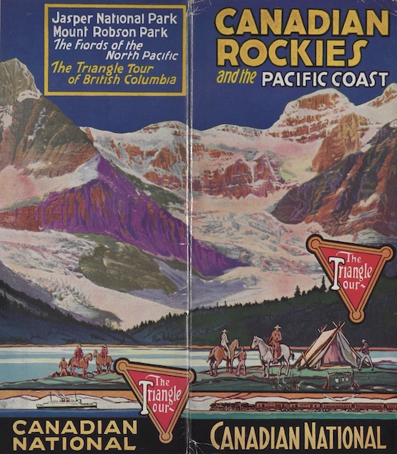 Click image to download a 14.4-MB PDF of this 26-page booklet.
Today’s Canadian Rockies booklet is from archive.org. The way archive.org presents this and similar publications is a puzzle. First, it cut the cover (shown above) in half, using the left half as the first page and the right half as the last page of the PDF. Since they are two halves of the same page, that’s obviously nonsense. I’ve merged them together and, based on similar CN documents from other years, placed them as the back cover of the booklet.
Second, unlike the other CN triangle tour booklets, this one apparently came with a large, fold-out map. Based on CN’s Jasper booklets, I presume this map was somehow attached to the inside back cover. The PDF is based on this reconstruction of the document. If I made a mistake, I hope someone will tell me how it should really be arranged.
Other than the map, this booklet is similar in outline to the 1933 edition, which is the closest I have to 1936. (I also have a 1940 version, but it puts the color cover on the front rather than the back.) However, the text and photos appear to be completely different. In addition to the color cover, the 1933 version had three serene color illustrations of scenes in the park, while this one has multiple colors only on the cover. Instead, most pages do have some cyan accents and the map has red lines representing CN routes and pale green representing water.