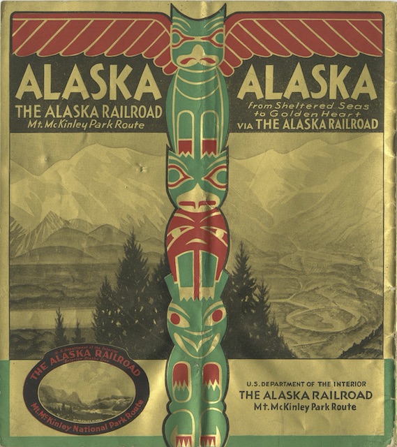
The golden color on the cover of this booklet is reminiscent of the 1939 Alaska Railroad booklet shown here previously. This 1934 edition shares some of the same headlines with the 1939 version, but the text and photographs are mostly if not entirely different.
 Click image to download an 11.1-PDF of this 24-page booklet.
The right side of the cover shown above (which is actually the back cover; the front cover is also gold but mostly text) shows “the Loop,” a 360-degree spiral that the railroad followed to gain elevation between Seward and Anchorage. We’ve seen it before in a Northern Pacific booklet about Alaska and it is also pictured on page 6 of this booklet. Like the Tehachapi and Williams loops, this was supposed to be an engineering marvel, but mainly it offered a photogenic rail line. Unlike Tehachapi and Williams, it was replaced by a more direct route in 1952.
I mentioned a few days ago that, to CN and CP, “Alaska” meant the Alaska panhandle. To the Alaska Railroad, it meant the populated corridor (which also featured Mt. McKinley) between Seward and Fairbanks. Of course, Alaska is so big that either of these routes present only a small slice of the entire state.
