Issued in 1957, this 18″x32″ map highlights Great Northern routes in red and Burlington routes in thick black. The Rio Grande and Western Pacific get medium-thick black lines. All other railroads are shown with thin black lines, though it might be possible to distinguish main lines as being slightly thicker than branch lines.
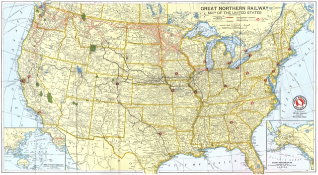
Click image to download a 6.5-MB image of this map. The back is blank so isn’t included in the PDF.
The Burlington, of course, was 48.4 percent owned by the Great Northern and connected with the Great Northern in Billings, Sioux Falls, and St. Paul. Interestingly, the Burlington’s Chicago-St. Paul line is shown in red, no doubt because it was the route of the Empire Builder. The entire Spokane, Portland & Seattle is also shown in red even though it was only half owned by the GN.
The Western Pacific connected with the Great Northern at Bieber, California on a route known as the “Inside Gateway.” The Santa Fe was also part of the Inside Gateway but didn’t get the favor of medium-thick lines. The Rio Grande didn’t connect with the Great Northern anywhere, but must have been emphasized as a favor to the Burlington, which exchanged traffic with it at Denver, and Western Pacific, which exchanged traffic with the Rio Grande at Salt Lake City.