This 108-page booklet is a combination of advertisement, travel advisor, and along-the-way guide for all of the routes of the Denver & Rio Grande Western in 1925. Although the Moffat Tunnel route was still nearly ten years away, the Rio Grande routes were far more far flung in 1925 than they were a few years later.
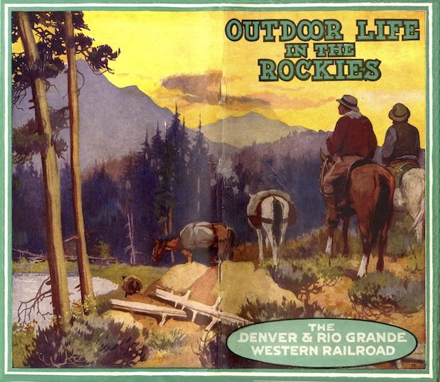 Click image to download a 24.7-MB PDF of this booklet.
The booklet opens with a 162-word introduction by Edwin Sabin, a noted travel writer who wrote a longer (500-word) introduction used by the Burlington in a booklet about Colorado and Utah. This was followed by eleven pages of text about the wonders of outdoor life. Most of the rest of the booklet was devoted to descriptions of towns and sights along the railroad.
The main route via the Royal Gorge and Tennessee Pass was described on pages 15 through 40. Pages 41 through 56 describe the secondary route via Marshall Pass, which is pretty much entirely gone today. The lines to Silverton and Santa Fe are described on pages 63 to 80. For some reason, these are preceded on pages 57 to 62 by a description of the Rio Grande Southern, then controlled by the D&RGW, from Ridgeway to Durango.
Finally, pages 81 to 98 describe D&RGW lines in Utah. This shows that the Rio Grande might have been a competitor with the Union Pacific for traffic to Bryce, Zion, Cedar Breaks, and the North Rim of the Grand Canyon (or Cañon as the booklet spelled it), as it once had a line from Thistle, on its main line, south to Marysvale, Utah.
Marysvale was about 70 miles to Bryce Canyon, compared with 77 from Union Pacific’s Cedar City. However, Cedar City was closer to Zion, Cedar Breaks, and the North Rim than Marysvale. A bus trip to all four parks/monument would have been 417 miles from Cedar City vs. 511 from Marysvale.
In 1961, Union Pacific closed its Cedar City branch and passengers to southern Utah parks had to board buses in Lund, 36 miles further away from the parks. This would have made the Marysvale route more competitive, but the Rio Grande had stopped running passenger trains to Marysvale in 1949. The D&RGW had probably lost interest in promoting southern Utah when Union Pacific built its lodges in the parks.
The last two pages of this booklet are devoted to two Rio Grande route maps, one of which is the usual railroad map showing every city and town along the lines and the other of which focuses on national parks and other scenic attractions. The cover art is signed with a G, which isn’t very helpful in identifying the artist today.