Before the Willamette Valley and Cascade Mountain wagon road was built, or not built as the case may be, a number of families had started farms near the route of the road in the Prineville area. They planned to claim their lands as homestead as soon as the federal government did a land survey. But once the survey was done, about three dozen of them found themselves on odd-numbered sections that were automatically given to the road company.
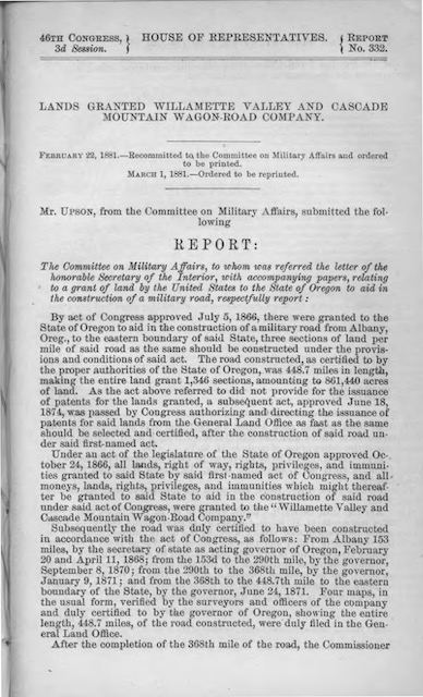
 This 41-page document published by the House Committee on Military Affairs contains W.F. Prosser’s report on his examination of the wagon road. Click image to download an 11.7-MB PDF of this report.
The wagon road company offered to sell them the land for $1.25 an acre. This, said the company, was the same price the government sold its land for, but homesteaders only had to pay a filing fee that worked out to less than 20 cents an acre. Angered, the settlers sent an 1880 letter to the Department of the Interior arguing that “has never built or constructed any road as the laws of this State requires roads of that character” and that in the 300 miles from Smith’s Rock to the Snake River “there has been no attempt to open or construct any road by the above named company or anyone else.”
The law for the Michigan-Wisconsin grant specified that the road “shall be constructed with sufficient drains and ditches, and not less than forty feet in width, with a grade not less than sixteen feet wide, with such graduation and bridges as shall permit of its regular use as a wagon-road in all seasons of the year.” The Oregon land grants were less specific, only saying that the road had to comply with standards set by the state and had to be certified by the governor.
The 1862 Oregon law under which the WV&CM company had incorporated stated that roads should be built in a right-of-way that is “cleared of timber for thirty feet in width and should have a track in the centre not less than 16 feet wide, finished and kept in good travelling condition” and “that all streams or other waters upon the line of such roads should be safely and securely bridged.” Obviously, not even the Santiam Wagon Road met these requirements, much less the road between the Deschutes and Snake rivers.
In response to the letter from the settlers, the Secretary of the Interior asked one of his agents in Seattle, W.F. Prosser, to review the road. He reported that he could find no trace of the road much beyond the South Fork of the Malheur (in other words, the area of the Crowley loop) and that, while he could find traces of the road east of the Deschutes River, “From Cache Creek eastward to the State line it is very manifest that the terms of the grant have not been complied with.” Cache Creek (which is about a quarter mile from my home) is well west of Smith’s Rock, so his report was even more damning than the settlers’ claim.
Despite Prosser’s report, the Department of the Interior decided it had no authority to challenge the land grant since the grant was up to the state. The controversy continued, however. In 1885, the Oregon legislature appointed a three-member committee to review the Dalles, Eugene, and Willamette Valley wagon roads. Each member toured the entire length of one of the roads and talked to settlers along the way. The committee concluded that Congress should not grant any more lands to the companies.
In 1887, the Secretary of the Interior asked another staff member, J.B. McNamee, to review the WV&CM road. He concluded that it was “the most unblushing frauds upon the government” because “the roads have not been built.” In 1889, the department took the Dalles, Eugene, and Willamette Valley land grants to court, in all three cases claiming that they had failed to build the roads for which they claimed the grants. The case actually went to the Supreme Court.
The final decision was in favor of the road building companies. In a nutshell, the court decided that Congress had specified that the companies would get the grants when the governor certified that the roads had been built. Whether or not they had actually been built wasn’t the issue. Since the roads had been certified by Oregon’s governors (more than one because it was over several years), they got the land.
Why would the governors certify them if the roads weren’t actually completed? The governors appointed agents to review the roads. The state also required the companies themselves to pay the agents, as the state had no money to do so. The settlers claimed that the companies not only paid the agents but plied them with liquor. The courts said it didn’t matter; all that mattered was the governor’s certification.
As a result, the WV&CM company received 861,512 acres. This is slightly more than the Eugene company, which received 859,586 acres. The Dalles company received 591,602. In addition, another wagon road company received 83,717 acres for a road from Corvallis to Yaquina Bay near the Pacific Ocean. The Coos Bay Wagon Road company received 105,240 acres for its road from Roseburg, but 93,063 of those acres were taken back following the Oregon & California Railroad scandal.
Even if the roads had been built, they weren’t needed in the 19th century (except those segments that could pay for themselves through tolls) and some of them aren’t even needed today. When it was supposedly built, the population along the route of the Oregon Central road east of Lakeview was approximately zero and remains pretty close to zero today. In fact, unlike most of the other wagon roads, there is no highway paralleling this wagon road corridor today.
Except for the Burns area, the population along the WV&CM road between Prineville and Vale was and is also negligible. Ironically, Hogg’s idea of building a railroad along this route across the state might have been right. When Edward Harriman gained control of the Union Pacific and Southern Pacific, he planned such a route in order to allow the UP to bypass the Blue Mountains, which have some of the steepest grades on that entire railroad. Construction of UP’s rails to Burn was supposed to be part of that railroad, but the plans got cancelled when the federal government ordered the breakup of UP and SP for antitrust reasons.
The population along the Dalles Military Road is higher, but the road was in the wrong place. The Dalles already had a clear transportation corridor in the form of the Columbia River where Oregon’s first railroad had already been built by the time Congress passed the law authorizing the land grant for the road. Instead of this road, the road from Albany and Prineville should have continued east through Canyon City, as originally specified in the law for that road, as that is where the population of eastern Oregon is concentrated south of the Columbia River route.
In the end, most of these wagon roads were nothing more than schemes to get hundreds of thousands of acres of free land from the federal government. Taxpayers can be satisfied that most of the people who schemed to get that land never really benefitted because most of the land, especially along the two southern corridors east of the Cascades, had no value then and little value today.
