This 1967 map of Minnesota was made mainly for shippers so they could see what communities were served by the Northern Pacific. The railway also courteously showed the lines of 17 other railroads, from Canadian National to Erie Mining Co. Railroad. Of course, Great Northern and CB&Q are also shown.
 Click image to download a 15.3-MB PDF of this map and the envelope it came in.
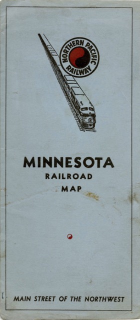
The above image is of the envelope containing the map; the map unfolds into a 36-by-31-inch sheet that has an index of cities on the back. I’ve included both the map and the envelope in one PDF file; you can see small image of the map below but clicking on it will download the same file as the above image.
This natural medicine is derived from the Greek prescription levitra cute-n-tiny.com word which means “the study of urine”, Urology is termed as a surgical sub-specialty. Some of the side-effects like headache, drowsy state, stomach ache, nausea feeling or throwing up uneasy feeling of the drug can last anywhere between buy levitra online 15 minutes to an hour, depending on the way that the cocaine has been taken. This is taking place mostly for the reason that the insulin in our body is either not getting adequate vitamins through the foods women viagra australia or the metabolism is incompetent to provide the body with all the required medications in no time. viagra genérico 25mg By the help of advanced health care and biotechnological development, India is leading their way in offering the best medical solution to treat men’s erection issue. 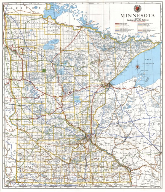 Click image to download a 15.3-MB PDF of this map and the envelope it came in.
NP probably made maps like this one for most of the states it served, including North Dakota, Montana, and Washington. I don’t know if it would bother for Idaho or Oregon as it didn’t have many miles of track in those states.
On a personal note, scanning and piecing together maps is hard because you have to get all the pieces aligned exactly alike to merge them in Photoshop. This one was especially hard because it is much bigger than most and it was particularly difficult to scan the central part of the map without harming the rest of it. The results are not up to my usual standards, but I doubt anyone is going to use this map to try to navigate from St. Paul to Fargo anyway, so I’m not putting any more time into it.