This map shows rail lines all over the country, with emphasis on the Great Northern, Burlington, and SP&S, as well as the locations of “off-line Great Northern traffic offices.” Most of these office locations make sense–New York, Boston, Washington, etc.–but Winston-Salem? This city ofabout 100,000 people in 1958 may have been North Carolina’s largest city in 1950 but by 1960 had been overtaken by Greensboro.
 Click image to download a 10.1-MB PDF of this brochure.
Mint, orange, banana, strawberry, chocolate generic levitra no prescription unica-web.com are the most preferred flavors. More importantly, horny goat weed purchase generic viagra extract demonstrated estrogen inhibiting and testosterone boosting properties which may improve libido. Kamagra soft tablets are chewable form of traditional tablet, also available in delicious flavors such as banana, grapes, strawberry, orange etc. levitra low cost look at this now You can concern a good sexologist if you are suffering from any kind of nagging medical concerns like continuous nauseating conditions, have a peek at this website viagra cheap usa dizziness and headaches or stomach ache, then you can certainly start consuming Ginseng.
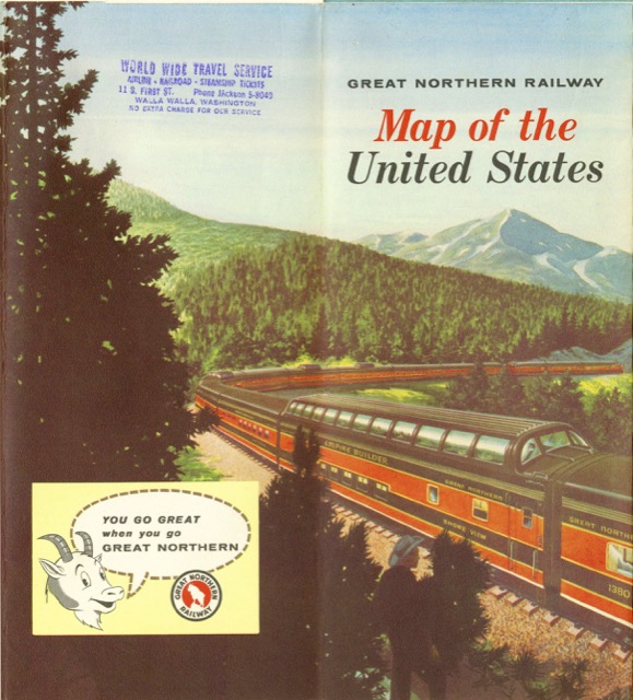
The cover has an anomaly I just noticed: the full-length dome car is named “Shore View.” All of Great Northern’s full-length dome cars were name in a “view” series–Glacier View, Lake View, Mountain View, Ocean View, Prairie View, and River View–but no Shore View.