1914 San Francisco Map

At about 26″x27″, this brochure is one-half panel wider than the California maps shown in the last two days. This makes it the equivalent of a 22-page 8″x9″ booklet. The use of a brochure size rather than a booklet allowed SP to print the map in a large enough scale to show every single street in San Francisco. Still, I suspect booklets became favored over brochures in a few years because of improvements in photo illustration technology, which more than made up for the loss of detail in any maps that would be printed in a booklet.

Click image to download a 16.9-MB PDF of this brochure, which was made from scans from the David Rumsey Map Collection.

This brochure was printed in anticipation of the 1915 Panama-Pacific Exposition, which was a celebration of both the opening of the Panama Canal and San Francisco’s recovery from the earthquake and fire that wiped out much of the city in 1906. In other words, unlike the California maps, it was more motivated by tourism than by attracting settlers to the state or city. Continue reading

The Road of a Thousand Wonders

We previously seen a 1918 postcard folder showing scenes along Southern Pacific’s Portland-Oakland route, also known as the Shasta Route. That fold described that route as “The Road of a Thousand Wonders.”

Click image to download a 30.0-MB PDF of this 80-page booklet.

This is a 1908 booklet on the same theme, but this booklet also covers SP’s Coast Line route from Los Angeles to San Francisco. The booklet is filled with well over 100 hand-colored photographs accompanied by plenty of text describing the sights along SP’s old route over the Siskiyou Mountains. As near as I can tell, only one photograph can be found in both the 1908 booklet and the 1918 postcard folder, but several photos are of the same scenes taken from slightly different angles. Continue reading

1907 California Map

This brochure is about the same size as yesterday’s and is still oriented more to potential settlers than to tourists. However, a hint of future tourism is indicated by the statement that this is the “National Education Association Edition.” The NEA held its 1907 convention in Los Angeles, giving many of its members a chance to learn about and enjoy the delights of California living.

Click image to download a 12.2-MB PDF of this brochure, which was made from scans from the David Rumsey Map Collection.

The brochure is arranged differently from yesterday’s. While yesterday’s said it told of “resources, attractions, topography, [and] climate,” yesterday’s map gave no hint of these things. Today’s is different. A large map shows the topography. A smaller map shows average temperatures. Another small map shows California’s area is greater than that of New York, Ohio, Maine, New Jersey, Massachusetts, New Hampshire, Vermont, Connecticut, and Rhode Island combined. Information about resources and attractions still depends on text on the back of the map. Continue reading

1901 California Map

The cover of this brochure says “resources, attractions, topography, climate, etc.,” but the map on the other side doesn’t show any of those things. Instead, it mainly shows state and county boundaries, Southern Pacific rail routes in thick lines, other rail routes in thin lines, and roads in faint dotted lines. If the map is to be believed, in 1901 the only roads in California fed into, but did not parallel, the rail lines.

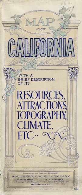
Click image to download a 15.6-MB PDF of this brochure.

The map also shows the location of cities, but only as stations on the rail lines. Los Angeles is shown as a small circle but I suspect even in 1901 its boundaries were bigger than that. San Francisco is shown at its current extent, but that’s the county boundary, not the city boundary of 1901. Continue reading

The Sternwheeler S.S. Casca

This combination brochure, menu, and postcard features the S.S. Casca, which carried passengers and freight on the Yukon River between Whitehorse and Dawson City from 1937 to 1952. The British Yukon Navigation Company (a part of the White Pass route) had the 180-foot-long sternwheeler built in Vancouver in pieces that were shipped to Whitehorse for final assembly. The ship replaced a 161-foot ship of the same name that had been built in 1911, which itself replaced a 140-foot sternwheeler of the same name that had been built in 1898.

Click image to download a 4.3-MB PDF of this brochure/menu/postcard.

The third Casca (which along with the others was probably named for the Kaska tribe) operated until 1952, after which it was stored in Whitehorse, along with another sternwheeler, the Whitehorse, as the government and historians debated whether to sell or try to preserve the ships as floating museums. The debate ended in 1973 when the two burned in a fire of mysterious origins. Continue reading

The Land of the Midnight Sun

Today’s booklet is the same size as yesterday’s, but has a different title and a different cover photo. Inside, however, the two booklets are nearly identical. The text is almost identical and four of the eight photos and the back cover map are also included in today’s booklet.

Click image to download a 3.1-MB PDF of this 20-page booklet.

I can find two differences in the text. First, yesterday’s booklet referred to Yukon River steamboats passing the Wood River, “sixty-two miles above Rampart.” Today’s booklet calls that river the Ray River, which is the name it is called today. (There is a Wood River in Alaska, but it is hundreds of miles away from the Yukon.) Based on this, I suspect today’s booklet was issued more recently than yesterday’s. Continue reading

North of the Arctic Circle

In 1914, the White Pass and Yukon, which had been running steamboats on the upper Yukon River (White Horse to Dawson), bought the Northern Navigation Company, which operated steamboats from Dawson to Tanana (near Fairbanks). This gave it a monopoly on those parts of the river until 1923. When the Alaska Railroad, which had reached the Tanana River in 1922, bought its own steamboats, the White Pass reduced its operations but continued to serve the area.

Click image to download a 3.7-MB PDF of this 20-page booklet.

This booklet promotes the “Yukon River Circle Tour,” but describes only a part of that tour in detail. Apparently, the entire tour consisted of taking an Alaska Railroad train from Seward to Nenana on the Tanana River, then steamboats to Dawson City and White Horse, then the White Pass railroad to Skagway. This booklet describes the route of the river boat from Nenana to Fort Yukon, which is above the Arctic Circle but still well short of Dawson City. Continue reading

Alaska, Atlin, and the Yukon

This booklet, like many before it, is titled Alaska, Atlin and the Yukon.” However, a notice on page 7 reports that the White Pass Route had to discontinue Atlin service due to “heavy losses.” “The decision to discontinue tourist service to Lake Atlin was reached after these booklets were printed, hence this notice.” The notice is dated January 1, 1937, the only date in the booklet, so probably the booklet itself was printed in 1936.

Click image to download a 4.3-MB PDF of this 8-page booklet.

Since the notice was glued in, it covers other text but I decided not to damage the item by removing it. Some of the text underneath it reads, “The lovely little town of Atlin lures the visitor with its quaint, flower-bordered streets, its curio shops and the Indian village nearby.” Apparently, it didn’t lure enough visitors. Continue reading

Alaska and the Scenic Yukon Country in 1915

This beautiful booklet has heavy-duty covers that are 4.4-inches wide holding 10 pages that are 4-inches wide. But the next 10 pages unfold to be slightly more than 8-inches wide, thus allowing for panoramic photos that wouldn’t fit on a 4-inch-wide page.

Click image to download a 7.6-MB PDF of this 24-page booklet. Click here to download a 1.9-MB PDF of the front-and-back cover spread.

The photos are all black-and-white or, to be precise, black-and-yellow as they all have a greenish-yellow tint. The tinting adds little to the images but fortunately most of the 40 photos in the booklet are still clear and crisp. Continue reading

Canadian Pacific October 1972 Timetable

Canadian Pacific timetables shrank from 36 to 28 pages in 1968 and remained that size at least through 1970. But today’s 1972 timetable was reduced to a mere 12 pages.

Click image to download a 7.8-MB PDF of this 12-page timetable, scans for which were provided by Hans Krieger.

Seven of these pages were filled with 13 schedules for about 17 different daily trains. Also included were an Algoma Central schedule, some bus and steamship schedules. Steamship service between Victoria-Port Angeles and Victoria-Seattle was listed as “suspended for winter.” Continue reading