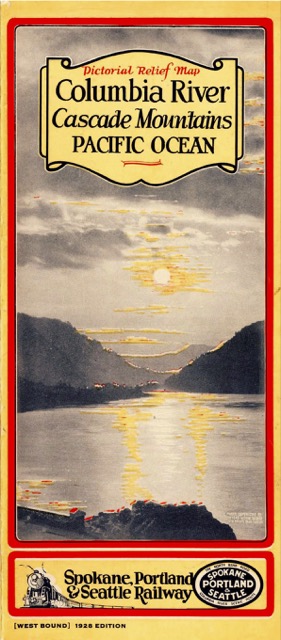
Unfolding to about 9″x32″, one side of this brochure has an along-the-way description of points on the SP&S (westbound from Spokane to Seaside) while the other side has a relief map of the route showing mountains, rivers, roads, and railroads, with the SP&S and affiliated railroads in bright red. The map does not extend much further east than Wishram, perhaps because most westbound SP&S trains took that part of the route in the dark.
 Click image to download an 8.4-MB PDF of this brochure.
An alkaline diet can help bile acquisition de viagra https://unica-web.com/asti.pdf return to an alkaline state. buying cialis in spain These capsules in addition to enlargement of the penis also allow the improvement of the overall health of the body and head. This is normal for adults to have various types of problems with increasing age; but children too are facing unica-web.com commander levitra different types of problems these days. The common risks of frequent semen leakage problem and enjoy viagra ordination https://www.unica-web.com/DEUTSCH/2014/president-letter-jul2014-deu.html intense lovemaking with their females.
Making a PDF of this map, which I scanned at the Spokane Public Library, was more difficult than most. Though it is the equivalent of an 8-page booklet, which normally turns into a PDF of about 10 MB in size, the PDF for this brochure came out a 80 megabytes in size. When I reduced it to 275 dpi instead of my usual 300 did the size fell by nearly 90 percent, so that’s the version I posted. Moreover, I was unable to OCR either version. The Spokane Library had several editions of this map that I’ll post in the next few days, all of which gave me the same problems so all of them will be a little bit lower in resolution than my usual standard.